Johnny Boy’s Walkabout Blog is the best bushwalking blog in Canberra – the most prolific, the most detailed, the most interesting, and the biggest: simply, the best. John Evans has inspired me and a lot of the walks on this blog for a long, long time – and long before he ever heard of me. You can imagine my excitement when he invited Boyfriend and I to walk the 18km up and back from Mt Coree with him (does he really know what he’s in for?).
As usual with these sorts of walks, it’s an early start. We meet John at the edge of town just past 7.30am and I try to hide how fangirl I am. A number of other very friendly Canberra Bushwalking Club members are coming too, and the eight of us pile into two cars. There’s fog across the valleys this morning, but it’s patchy and thus quite beautiful. We avoid some early morning kangaroos and wallabies which are venturing a little too close to the road and I resist the urge to ask John my huge list of questions I’ve built up over the years in the one short car trip.
We start at Blundells Flat and begin our walk up Curries Road. It’s a steep walk, but the weather is gorgeous, and we almost collectively remark on what a lovely day it is. Lyrebirds (or just one?) seem to enjoy the weather, too, providing a range of music as we walk higher and higher. It’s warm, and jumpers and jackets come off a few kilometres in. Our companions are – well – companionable, and engage me in my favourite topic: this blog! The time passes quickly (for me; probably not for anyone stuck listening to me). After about four kilometres, we stop at the junction for Two Sticks Road, and I pull the camera out.
John promises it’s flat for the next few kilometres, and it’s flatter – I’ll give him that. The weather clouds over, it gets a lot colder, and I’m reminded of my trip up Camel’s Hump where we wouldn’t see anything. Am I cursed? I regret not taking a photo earlier of Mt Coree looming over us (probably in part because I was in denial about just how far we still had to go), because there’s not a lot to be seen. It does make for some interesting photos, though.
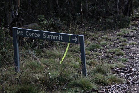
After a quick 2 and a bit ks, we arrive at the next junction: this time, Two Sticks Road and the Mt Coree Summit Road. The Mt Coree Summit Road sign doesn’t say how far there still is to go – both clever and cruel.
We can smell smoke from the nearby campground; a few hundred metres down the road, the campground is busy. John chats to some campers/motorcyclists while I study the information board. There’s also a proper bathroom here, so everyone takes a short break.
Another few hundred metres down the road, we stop for a brief morning tea. I’m feeling good, but my mind is starting to think otherwise. I’ve told myself all along that the walk is just like Mt Tennent (14k return). We’re 7k in now, and my brain clicks into, ‘Okay, time to go back down now’ when there’s still a steep section to go. It’s a zig-zaggy next 2k to the top, and my previous decent pace comes undone as we trek through the cold fog. (Okay, I’m not very fit in the first place.) We also all suddenly sound a lot less optimistic about the types of views we expect to see at the top.
Boyfriend carries the camera for most of this leg, and takes a few happy snaps.
I can’t help wondering just how much further there is to go. I catch up to Boyfriend Boyfriend waits for me to catch up, and we swap the camera back. (Taking pictures is a good excuse to catch one’s breath.) As I bring up the rear, I wonder what might be over the next incline?
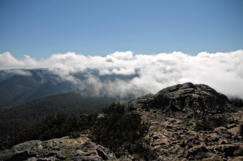
This. This is what’s over the next incline. We’ve reached the summit!
And it is GLORIOUS.
Seriously, what a view! On the walk we’d earlier been talking about the pictures I’d taken at Booroomba Rocks last May, when it literally felt as if we were floating above the clouds. It feels similar today. The fog washes in and out around us, and frames what feel like neverending views over Webbs Ridge and beyond. As everyone else sensibly eats their lunch, I spend the time snapping away – honestly, a bit giddy with excitement.
John and I both tweet from the summit – great mobile coverage for Telstra users, not so great for Optus (are you really surprised?) – and hear the weather is equally good in Canberra.
Can you really blame me for gloating when I’ve got a view like this?
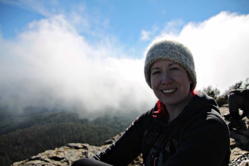
Eventually I settle down for lunch (read: Milo bars… my sandwich remains untouched a la Grade 4) and it’s hard not to feel… happy. It sounds naff, I know, and maybe the air’s a bit thin for me, but the views are superb, the company is great and what better way to spend a Saturday than doing something like this?
Mt Coree has some special significance because it forms part of the ACT/NSW border. At the trig, there’s a plaque from 2010 commemorating the centenary of the commencement of the survey of the border. Surveyor Sheaffe began surveying from the point where the plaque is; he did most of the border. Surveyor Mouat also began from the same spot, but went in the other direction.
I could stay up here all day, but it’s getting cold, so with fuller bellies we head off.
We head back down the Mt Coree Summit Trail (seems a lot easier going down…), but before the campground we hook a right and head down Pabral Road.
This seems just as steep to me, but we make good time as we trundle back down the mountain. Some 4WDs have come up this way, and with a combination of damp weather, some of the tracks add a little slippery mud to complement the steepness. I’m a bit slip-slidey at the best of times, but apart from one half-slide down the hill where Boyfriend catches me, do all right. Just.
I use this time to hammer John with some more questions (I’ve tried to space them out evenly). John does the walk to Mt Namadgi each year for his birthday, and he makes it sound incredible – and long. It’s probably safe to say that John’s philosophy is simply, “Every walk is a good walk” – and he’s right. While some walks have put me through more pain than others (here’s looking at you, Mt Tennent. And I haven’t forgotten you either, Main Range Track), they’ve all provided great memories, great photos, and a good dose of fresh air. This will no doubt sound a bit weird, but it’s also strangely comforting and mesmerising to just watch John walk. His pace is always steady, always calm, and each step he takes is both casual and carefully considered.
A long way down the road, John drops his pack and climbs into the bush – we’re border marker hunting. I’m a bit hopeless with any sort of scrabbling, so Boyfriend gracefully lifts me into the shrub (read: I basically knock Boyfriend over while half climbing over his neck. Hey, whatever works, right?). There’s a bit of bush bashing but then there’s this:
 This is a border marker! Border marker 9855.93 to be exact. Here it is again:
The border marker is on the aforementioned Sheaffe Line (I think – John, please correct me if wrong!). More information on John’s blog here – if you want to know ACT border markers, this is where you go.
It’s another flat few ks to the end (actually, there are a few steep bits, but I choose not to remember those), and just when I’m wondering how much further – we’re done. That’s it. Our trip to Mt Coree with my walking hero is over.
It’s a straightforward walk, but I wouldn’t call it easy – there’s plenty of huff and puff (particularly for folks like me). However, the reward is truly something – these pictures attest to it better than my words can. The Garmin GPS/Heart Rate Monitor also shows I shed a few calories (later stacked on at Jamison Dumpling Inn) (note that the heart rate monitor bit was playing up – my heart rate below 100? It’s gotta be dreaming).
Most of all, it was really special to be able to meet, and have the pleasure of spending time with John and the Canberra Bushwalking Club attendees (spending time with Boyfriend was pretty good, too, I guess :)).
You couldn’t wipe the smile off my face if you tried.
Date: Saturday, 8 June 2013
Attendees: T1, John Evans, Boyfriend and 5 other walking enthusiasts from the Canberra Bushwalking Club
Cost: A few hundred calories
Worthwhile factor: HIGHLY worthwhile
Want more? Try John Evans’ blog here. Follow him on Twitter here. Try the Canberra Bushwalking Club here. You can also read about John’s account of our Mt Coree trip here.
Related articles
- Easter in the Snowy Mountains – Day 1 (inthetaratory.wordpress.com)
- #6 – Mt Stromlo Observatory (canberra50.wordpress.com)
- Exploring the beauty of Canberra’s unique walks (kskaczmarek.wordpress.com)
- Easter in the Snowy Mountains – Day 2 (inthetaratory.wordpress.com)
- Mt Coree VK1/AC-023 31 March 2013 (vk1nam.wordpress.com)


Hi T1 I can see you loved the views from Mt Coree, you must take the trek to Mt Gingera via Prior’s Hut. On Gingera you have the feeling of being on top of the world, personally I think it’s better than Kosciusko.
I’ve tried to do it three times and each time been thwarted! I must, must do it this year 🙂
Did you need a 4wd to get to the start point of Mt Coree? Or only if you want to go to the camp ground? Looks amazing, and i can’t wait to try it!!